By MixiTVFocus Science Feature – October 2025
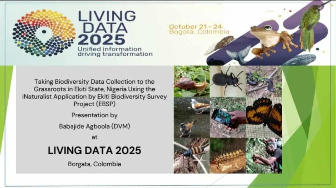
At the #LivingData2025 Conference in Bogotá, Colombia, Nigeria’s scientific voice resonated on a global platform as Dr. Babajide Agboola, founder of Agbo-Veterinary and Environmental Consult (AVEC), presented groundbreaking research on geo-spatial biodiversity mapping through community engagement in Ekiti State.
His presentation, titled “Citizen Science to the Grassroots: Taking Biodiversity Data Collection to the Grassroots in Ekiti State, Nigeria Using the iNaturalist Application,” highlighted how the Ekiti Biodiversity Survey Project (EBSP) is pioneering the integration of geo-spatial technology, mobile data, and indigenous knowledge to reshape how biodiversity data is collected, visualized, and used for conservation planning.
 From Local Observations to Global Maps
The heart of Dr. Agboola’s work lies in geo-referenced biodiversity documentation — a data-driven approach where every recorded species observation carries precise spatial coordinates. Using the iNaturalist mobile platform, community participants — including students, forest guards, hunters, and local youth — photograph plants and animals, automatically tagging each observation with latitude, longitude, and time stamps.
These real-time records are uploaded to the iNaturalist global database, where experts validate identifications, creating a dynamic and growing dataset of Ekiti’s biodiversity.
The result is a digital biodiversity map — a living, evolving visual of the region’s ecological health. This map provides insights into species distribution patterns, habitat fragmentation, and ecological hotspots. It also aids local authorities in identifying areas of conservation importance, such as sacred groves, riparian corridors, and forest reserves.
Geo-Spatial Insights: Mapping the Invisible
Dr. Agboola’s team employs Geographic Information Systems (GIS) and remote sensing tools to overlay citizen-generated data with satellite imagery, land use maps, and forest cover models. This combination reveals how ecosystems respond to human activity, climate pressure, and land-use change.
Key discoveries include:
-
Identification of over 1,000 plant and animal species, including endangered species like the Ibadan Malimbe (Malimbus ibadanensis) and the Hooded Tick Spider (Ricinoides).
-
Hotspot mapping showing biodiversity concentrations around sacred groves such as Igbo-Olosunta (Ikere Ekiti) and Oke-Orin (Ijero Ekiti).
-
Detection of ecosystem degradation trends linked to agricultural expansion and urbanization.
These spatial analyses help visualize biodiversity beyond numbers — they show where life thrives, where it’s under threat, and where intervention is most needed.
Community Meets Technology: A New Model for Data Ownership
Unlike traditional biodiversity research led by external institutions, the EBSP model flips the paradigm — it brings science to the people. Participants use everyday smartphones to record data, giving rural communities a stake in environmental decision-making.
Workshops and trainings, led by AVEC and supported by the Ekiti State Forestry Commission and the Global Learning Exchange Network (GLEN), equip locals with practical GIS and field observation skills. Students from secondary schools in Ikere, Iyin, and Aramoko now participate in citizen-led bio-blitzes, while traditional custodians document the flora and fauna around sacred forests.
This fusion of geo-spatial data and indigenous ecological knowledge bridges modern science with traditional stewardship — ensuring that conservation efforts remain culturally relevant and locally driven.
Science, Policy, and Open Data Integration
By aligning with iNaturalist’s open-data framework, the project ensures that Ekiti’s biodiversity data feeds into national and global datasets, including the Global Biodiversity Information Facility (GBIF).
Dr. Agboola’s presentation emphasized how geo-spatial citizen science can strengthen environmental policy by providing accurate, real-time data for land management and conservation planning. Policymakers can now visualize biodiversity richness maps when allocating protected areas or designing reforestation programs — a leap forward from outdated, paper-based surveys.
He also proposed that sites like Oke-Abanijorin, Igbo-Ogun, and Igbo-Olosunta be formally recognized as Community Protected Areas (CPA) under Ekiti State’s forestry laws, backed by empirical GIS data and cultural validation.
A Blueprint for Africa’s Conservation Future
The inclusion of Dr. Agboola’s presentation at Living Data 2025 marks Nigeria’s entry into the global discourse on open biodiversity data, geospatial science, and citizen-driven conservation. His work demonstrates how low-cost mobile tools, when paired with open data systems and spatial analysis, can democratize scientific discovery.
More than 7,000 geo-tagged records now exist because of ordinary citizens in Ekiti who turned curiosity into contribution. Their data not only enriches global biodiversity repositories but also serves as a geospatial foundation for conservation policy, environmental education, and ecotourism planning.

Conclusion: Mapping the Future, One Observation at a Time
Dr. Babajide Agboola’s work through the Ekiti Biodiversity Survey Project represents a scientific and social breakthrough — a case where geo-spatial intelligence meets grassroots participation. By merging satellite insight with smartphone simplicity, he has shown that the next frontier of conservation is not locked in laboratories but alive in the landscapes we share.
As the world looks for scalable, community-driven environmental solutions, the Ekiti model offers a replicable pathway: from local action to global data, from observation to preservation, from Ekiti to the world. #LivingData2025 #GeoSpatialScience #CitizenScience #EkitiBiodiversitySurvey #iNaturalist #SustainableConservation #MixiTVFocus #OpenData #NigeriaInScience


